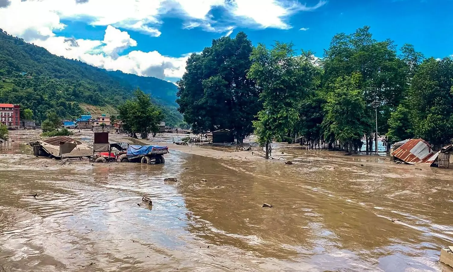
The flash floods that struck Nepal on August 26 warn that Himalayan disasters are becoming more complex than conventional flood models assume. From an engineering perspective, this was not simply a river overflowing after heavy rain. It was a cascading hazard: an ice-rock avalanche, sudden river blockage, debris flow, infrastructure failure and inadequate evacuation time converged in a densely settled mountain corridor.
The immediate trigger was the collapse of a glacier in the Langtang region. Ice and rock plunged roughly 1,200 metres into the valley, generating an avalanche that entered the Lhende Khola and Bhote Koshi system. The United States Geological Survey clarified that the seismic signal initially interpreted as an earthquake was produced by the glacial collapse itself. The surge carried boulders, sediment and debris downstream. River levels reportedly rose by about nine metres within 30 minutes.
More than 350 deaths have been reported across Nepal and Tibet, with more than 1,300 still missing. Roads, bridges, settlements and power infrastructure were swept away. Rescue operations have consequently been constrained by the destruction of infrastructure needed to reach victims. The lesson: when hazards cascade, infrastructure can become the principal point of failure.
Climate change forms an important part of the background, although warming alone cannot explain it. The Hindu Kush Himalayan region is warming. ICIMOD reports that glaciers across the region lost about 12% of their area and 9% of their ice reserves between 1990 and 2020. Three-quarters of the region’s glaciers are smaller than 0.5 square kilometres and vulnerable. Warming can accelerate melting, weaken ice-rock interfaces and destabilise slopes. It can also enlarge glacial lakes, increasing outburst-flood danger.
But climate change interacts with geology and human development. The Himalayas are tectonically active, steep and naturally fragile. Roads, hydropower projects, transmission lines, tourism facilities and settlements are concentrated along narrow valleys because flat land is scarce. Such infrastructure creates exposure: one bridge failure can isolate communities, while a blocked road can delay care.
India must treat the Nepal disaster as a cross-border preparedness issue. The Himalayan drainage system ignores political boundaries. Rivers flowing from Nepal eventually enter Bihar, Uttar Pradesh and other parts of the Ganga basin. Indian Himalayan States, including Uttarakhand, Himachal Pradesh, Sikkim and Arunachal Pradesh, face comparable combinations of cloudbursts, landslides, glacial lake outbursts and flash floods. Assam and West Bengal must prepare for sudden changes in river discharge and sediment loads.
The first lesson is to build multi-hazard early-warning systems. Rain gauges alone are insufficient. India needs integrated networks combining automatic weather stations, river-level sensors, seismic instruments, satellite imagery, high-altitude cameras and glacier monitoring. Warnings must specify which villages should evacuate, by which route, and within how many minutes. Artificial intelligence can assist anomaly detection, but cannot replace field verification or community response.
Second, infrastructure codes must reflect future hazards rather than historical averages. Bridges should be assessed for debris impact and scour; roads for landslide susceptibility; hydropower projects for probable maximum floods and sediment surges; and settlements through updated hazard zonation. Critical facilities need redundancy. A hospital, communication tower or evacuation shelter should not depend on a single vulnerable road or bridge.
Third, India needs stronger transboundary disaster protocols with Nepal. Real-time hydrological, meteorological and geological information should be shared routinely. Joint exercises should involve the National Disaster Response Force, State Disaster Response Forces, armed forces, engineers, hydrologists, local administrations and communities. Alerts should reach people through cell broadcast, sirens, radio and satellite communication, especially where mobile networks fail.
Finally, land-use planning must become a core disaster-risk measure. Building in active floodplains, unstable slopes and narrow river corridors converts natural hazards into human catastrophes. Development cannot be stopped, but it can be made risk-informed through carrying-capacity assessments, slope stabilisation, drainage management and hazard-map enforcement.
The Nepal tragedy demonstrates that tomorrow’s flood may not resemble yesterday’s flood. For engineers, the lesson is to design for cascading failure, uncertainty and resilience. For disaster managers, it is to connect scientific warning with last-mile evacuation. For governments, prevention is cheaper than reconstruction.
India should not wait for a Himalayan catastrophe within its own borders to test these lessons. The time to strengthen monitoring, infrastructure and communities is before the next warning.