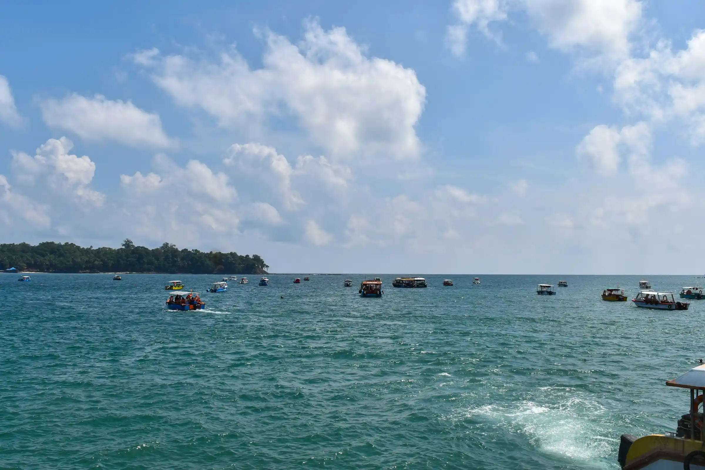
For a long time, India’s Andaman and Nicobar (A&N) group of islands has remained outside the national consciousness. Even in academia, students incorrectly identify Kanya Kumari as India’s southernmost point, overlooking Indira Point on Great Nicobar Island. This neglect, even decades after independence, may be explained by the continental mindset of India’s political and intellectual leadership, given that the islands lie about 1,200 kilometres from India’s eastern coastline.
To many in India, the islands evoke only the infamous Cellular Jail, built by the British in Sri Vijaya Puram (then called Port Blair) to house Indian political prisoners, whose sentence of exile across the ocean was often referred to as “Kala Pani”. Among those imprisoned were Vinayak Damodar Savarkar (Veer Savarkar), Batukeshwar Dutt, and Barindra Kumar Ghosh. These islands are also home to some of the world’s most primitive tribes: the Great Andamanese, Onge, Jarawa, and Sentinelese of the Andaman group of islands, and the Nicobarese and Shompen of the Nicobar group. Apart from the Nicobarese, who are relatively more integrated with modern society, the other five are classified as Particularly Vulnerable Tribal Groups (PVTGs) and receive strict legal protection.
But the Islands are much more than mere statistics in historical and geographical data. Stretching about 800 kilometres in a north-south arc and reaching a maximum width of about 150 kilometres across the Bay of Bengal, the entire group comprises 836 islands, islets and rocks. Of these, 572 are islands, 31 of which are inhabited. Landfall Island, the northernmost island of the Andaman group, lies about 18–20 km from Myanmar’s Cape Negrais. Great Nicobar Island, the southernmost island in the Nicobar group, whose southern tip is Indira Point, lies about 163 km from the northern tip of Sumatra in Indonesia. The Islands thus straddle a crucial geographical space between the Indian and Pacific Oceans.
The land area of these islands is significant, covering 8,249 square kilometres, 86% of which is forested, making them one of India’s most densely forested regions. In relation to the mainland, the A&N Islands account for just 0.25% of India’s total land area. However, a different perspective emerges when one considers that the A&N Islands are larger than 61 sovereign countries, including Singapore, Bahrain, Luxembourg, Mauritius, Brunei, and Palestine. Importantly, these Islands, with a coastline of about 1,962 kilometres, generate, under the provisions of the United Nations Convention on the Law of the Sea (UNCLOS), an Exclusive Economic Zone (EEZ) in the eastern Indian Ocean of about 600,000 square kilometres, roughly a third of India’s total EEZ.
The A&N Islands are rich in tourist potential that has remained undeveloped. Jacques Cousteau, a Frenchman and internationally recognised professional diver, made a film in the 90s titled Andamans: The Invisible Islands. Cousteau said he had dived all over the world, but the most diver-friendly and beautiful underwater habitat he found was in the waters of the Andaman Islands. This view has also been echoed by the global Professional Association of Diving Instructors (PADI). Besides their beautiful coral reefs, the A&N Islands are rich in flora and fauna and boast some of the most beautiful beaches, making them a veritable tourist paradise.
Following a change of government at the Centre in 2014, the strategic importance of the Islands came into renewed focus, with plans to transform them into India’s first maritime hub. In 2015, the Ministry of Shipping formulated a Rs 10,000 crore, 15-year perspective plan to develop 23 port sites across the archipelago and to expand the dry dock and ship-repair industry at Sri Vijaya Puram. This included the acquisition of 60 cargo and passenger vessels at a cost of approximately Rs 5,000 crore and the establishment of a container transhipment terminal at Galathea Bay in Great Nicobar. The plan stalled on environmental grounds.
To coordinate across ministries, the Island Development Authority (IDA) was constituted in 2017 under the Ministry of Home Affairs, with a mandate to oversee development on 26 identified islands. To this end, the 320-kilometre-long Andaman Trunk Road (ATR), connecting the districts of North, Middle and South Andaman, was taken over by the National Highway Authority of India (NHAI). Renamed NH 4, the road’s double-laning is nearing completion. One bridge, the Azad Hind Fauj Setu, a state-of-the-art bridge over the Humphrey Strait, is now operational, while the Middle Strait bridge is under construction. Scheduled for completion in 2027, it will reduce the day-long journey to about five hours.
The IDA also completed a digital connectivity project in August 2020, the foundation stone of which was laid by Prime Minister Modi on 30 December 2018. On that day, Port Blair was formally renamed Sri Vijaya Puram. The project involved laying a 2,600 km undersea fibre network from Chennai to Sri Vijaya Puram and from there to the outermost islands. Consequently, Sri Vijaya Puram now has 200 Gbps connectivity, while the outermost islands have 100 Gbps.
After NITI Aayog assumed responsibility for the strategic development of the islands from the Ministry of Shipping, the Great Nicobar Island Development Project (GNIDP) was launched in 2021. This holistic project aims to transform the GNI into a multimodal hub comprising a transhipment port, an international airport, a township, and a power plant, with the vision of developing Great Nicobar as a sustainable, green, global destination for business, trade, and leisure. In November 2022, the project received environmental clearance and was reconceived at a projected cost of Rs 81,000 crore. This marked India’s commitment to pursuing holistic development with ecological integrity.
As mentioned earlier, Great Nicobar is the southernmost island in the Nicobar group. The Greenfield GNIDP, scheduled for completion in four phases, comprises an International Container Transhipment Terminal (ICTT), an international airport, a power plant, and an integrated township covering 166 square kilometres. The ICTT at Galathea Bay will eventually have a capacity of 16 million TEUs, with the initial phase at 4 million TEUs. Its proximity to the Six Degree Channel and the Strait of Malacca and its position along major shipping routes make it a crucial maritime transhipment hub for India. The dual-use Greenfield International Airport is planned to handle 4,000 passengers per hour at peak capacity and will support both civilian and military flights.
The power plant will have a capacity of 450 MVA. It will supply power to the ICTT and the integrated township, which includes two new greenfield cities at Campbell Bay and Galathea Bay, a cruise terminal, luxury resorts, and industrial facilities. This Rs 81,000 crore project marks the first comprehensive attempt to integrate national security objectives with regional economic development in the Bay of Bengal by positioning the islands as a strategic economic hub.
Geography dictated the choice of Great Nicobar Island for the project, as it lies just 40 nautical miles from the East-West shipping line, which runs along the 6-degree channel and passes through the Strait of Malacca. Galathea Bay, at the southern tip of the island, is thus an ideal location for a transhipment port. The island’s bays are silt-free, reducing construction and maintenance costs. Most importantly, Galathea Bay has a 20-metre draft, enabling the entry of large super tankers. However, this ambitious venture to create a strategic centre for trade, logistics, tourism, and defence has come under scrutiny, with critics arguing that the GNIDP will be detrimental to the environment and the indigenous tribal population. Critics also call it a “planned misadventure” that will endanger one of the world’s most unique ecosystems of flora and fauna. While subtly recognising the project’s strategic and economic value, critics aver that it has been hastily approved without adequate legal and social safeguards and that the disaster risk far exceeds the potential benefits.
The criticism, however, is more political than factual. Such debates should never be cast as a choice between development and environmental protection, forcing a decision-maker to choose one or the other. Long-term development depends on healthy ecosystems, and environmental protection is more durable when people have livelihoods, infrastructure, and economic opportunity. Development without environmental stewardship becomes fragile and costly; environmental stewardship without development lacks social and political durability. Sustainable development integrates economic growth and social well-being, with ecological resilience reinforcing them. The debate on the GNIDP, therefore, should not be framed as a choice between development and environmental protection. It should be about ensuring adequate measures to address environmental concerns as development proceeds.
Environmental Safeguards
A dispassionate appraisal of the GNIDP indicates that environmental protection has been integrated into every facet of the development effort and remains a priority. Several agencies have been engaged for the Environmental Impact Assessment (EIA), including the Zoological Survey of India (ZSI), the Salim Ali Centre for Ornithology and Natural History (SACON), the Wildlife Institute of India (WII), and the Botanical Survey of India (BSI). An Expert Appraisal Committee (EAC) has also been constituted, with members from the Indian Institute of Science (IISc), the Indian Institute of Technology (IIT), the National Institute of Ocean Technology (NIOT), the National Centre for Coastal Research (NCCR), and the National Institute of Oceanography (NIO). Despite this, three issues continue to be flagged by many people. These concern the safety of leatherback turtles, tree-cutting, and the welfare of the tribal population.
Some believe that Galathea Bay is the only nesting site for leatherback turtles and that it is being lost. That is not true. There are 23 turtle nesting sites in the Andaman and Nicobar Islands, with 16 on Great Nicobar Island. While Galathea Bay is one of the sixteen nesting sites, the environmental clearance for Galathea Bay forbids any development within 500 metres of the high-tide line to ensure that leatherback turtles’ nesting sites are not disturbed. There will also be no development west of Galathea Bay, where the custom nesting sites are, during Phases 1 and 2 of the project.
In addition, the environmental clearance mandates that turtles be geo-tagged to inform scientists of their locations and to determine whether they are returning. In addition to the leatherback turtles, the WII has been tasked with preparing and implementing a conservation and management plan for saltwater crocodiles. The WII will also establish a Field Research Unit in GNI for 30 years to undertake uninterrupted research and conservation interventions. In addition, a research station will be set up at GNI with office space and accommodation for WII, BSI, SACON & ZSI teams. No tourism will be permitted on the Western Flank of Galathea Bay at any stage.
Depletion of forest cover is another concern that has been flagged. As part of the environmental effort, 65 sq km of the 130 sq km of affected forest area is green and will not be touched. The remaining area has 18 lakh trees, of which 7.1 lakh will be cut over the next 30 years. Before a single tree has been cut, 2.4 lakh trees have already been planted under the “Ek Ped Maa Ke Naam” scheme. An additional 6 lakh trees will be planted under this scheme by the time phase one starts, making the total number of trees planted more than the number that will be cut. In addition, compensatory afforestation will be carried out, with the number of trees to be planted equal to twice the number to be cut. This compulsory afforestation is planned over 27 square kilometres in Haryana, as the A&N Islands lack sufficient space to plant those trees.
The third issue concerns the tribals, whose preservation and safety are a high priority. The project is mandated not to disturb them or their habitations. Of the 910 sq km of Great Nicobar Island, 751 sq km (82.5%) is designated as a tribal reserve. This vast area, slightly larger than Singapore, is home to about 200-250 Shompens and about 1100 Nicobarese. Interestingly, when the Shompens fall ill or need medical attention, they come to the INS Baaz hospital at Campbell Bay on their own for treatment! 75 sq km of tribal area is being de-notified, and 79 sq km is being re-notified, increasing the tribal area by 4 sq km. As per the EAC notification, the tribal area will be geo-fenced, and entry will be prohibited. All actions undertaken in the GNI will be in accordance with the A&N (Protection of Aboriginal Tribes) Regulations, 1956. To put things in perspective, the notified tribal area is larger than the area of many Indian cities such as Bangalore, Jaipur, Indore, and Pune. This will not be interfered with.
Specific agencies have been tasked with planning, implementing and monitoring conservation efforts. The Wildlife Institute of India (WII) is responsible for protecting sea turtles and saltwater crocodiles. Protection of the Nicobar megapode has been entrusted to WII and the Salim Ali Centre for Ornithology & Natural History (SACON). SACON will also look after all bird species on the island. The Botanical Survey of India (BSI) will oversee flora, and the Zoological Survey of India (ZSI) will oversee intertidal flora and fauna, as well as coral preservation. Dredging protocols will follow standards set by the International Union for Conservation of Nature (IUCN), the world’s oldest and largest global environmental network, headquartered in Switzerland.
Three independent Monitoring Committees will oversee the implementation of the Environmental Management Plan (EMP). These committees will address issues relating to pollution, biodiversity, and the welfare of Shompen and Nicobarese tribals. In addition, an overarching Committee under the Chief Secretary (A&N) will oversee a 30-year Wildlife Conservation Plan, a 50-year Tribal Welfare Plan, and all aspects of compensatory afforestation.
Questions have been raised in certain quarters about the need for a new Greenfield airport, given that extending the existing airfield at INS Baaz to a 3000-metre runway could meet the project’s needs. The matter was considered and dropped, as implementing it would have posed a different set of hurdles. The extension of the runway required the cutting of a hill on one side, which fell within the International Civil Aviation Organisation (ICAO) safety arc. Apart from being an ecological disaster, the hill is traversed by the West-West Road, which provides connectivity to the Island’s people. Cutting the hill would deprive them of this connectivity. And if the runway were extended on the other side, it would require extensive sea reclamation at a very high cost. The seaside is also a turtle nesting site, which would be permanently lost.
Another factor to consider was that 80% of the population of Great Nicobar Island lives in the area around INS Bazz. This includes the hospital, the dispensaries, and the school. Under the 15-degree safety arc required by ICAO regulations, most of this population would have to be removed and relocated, raising a different set of challenges. That was why the proposal to extend the runway was abandoned, and approval was granted to build a new Greenfield airport in an area that is barren, devoid of trees, and poses no ecological or other concerns.
Commercial Aspects
Galathea Bay is an ideal location for the International Container Transhipment Terminal (ICTT) because it has a natural draught of 20 metres and lies just 40 km off the 6-degree channel, through which the world’s shipping passes via the Strait of Malacca. The East-West International Shipping Lane (ISL) charts a course from the Suez Canal through the Red Sea via Bab el-Mandeb. Another Shipping Lane starts from the Strait of Hormuz. Both then pass south of Sri Lanka into the six-degree channel, then into the Strait of Malacca. This is where geography gives Galathea Bay a tremendous advantage.
Supertankers offload their containers at such transhipment ports, from which smaller ships take them to their designated destinations. They use as few departures from the recognised International Shipping Lanes (ISLs) as feasible. For the Galathea Bay ICTT, its distance from the ISL is a significant advantage. Supertankers traversing the Red Sea or starting from the Strait of Hormuz travel along the length of the Arabian Sea, skirt Sri Lanka, and enter the Strait of Malacca. After Singapore and Port Klang in Malaysia, which are essentially at the top of the ISL, Galathea Bay, on Great Nicobar Island, has the least variation. The port, once constructed, can emerge as a regional transhipment alternative for selected trade flows currently routed through Singapore, Port Klang and Dubai in the medium- to long-term.
The International Container Transhipment Port (ICTP) at Galathea Bay is being constructed in four phases under a PPP model, with the final phase due in 2057. Phase I of the project will be completed within four years of the contract award and will have a capacity of just under 6 million twenty-foot equivalent units (TEUs). The final phase will have a capacity of close to 21 million TEUs. The airport will be dual-use, with a 3000-metre runway in Phase 1 and a 4000-metre runway in Phase 2. The power plant will be developed in four phases, with the final phase in 2075. This 450 MVA hybrid power plant will rely on a mix of gas, solar, and battery storage to reduce dependence on diesel. Of the 166 square km set aside for the project, 150 square km will comprise the township, which will be developed in three phases and completed by 2047.
Because of the long gestation period and the existence of well-established transhipment ports in Sri Lanka (Colombo and Hambantota), Malaysia (Klang and Tanjung Pelepas), and Singapore, critics argue that the Galathea Bay project may not be commercially viable. The market is dominated by existing transhipment hubs that already benefit from mature feeder networks, integrated logistics, and repair facilities. Galathea Bay has no industrial hinterland, and everything required to run the port must be transported from the mainland. This will increase costs and make it challenging for the ICTT at Galathea to compete with the established ports. But its outstanding location and natural deep water, which can accommodate the largest container vessels with minimal dredging, are an advantage.
But it is not only the depth of ports that matters. For example, though Hambantota has a deeper port than Colombo, ships prefer transhipment at Colombo owing to higher throughput, more mature infrastructure, shipping-line confidence, and an established logistics ecosystem. India’s seaport at Vizhinjam in Thiruvananthapuram can be an alternative to Colombo as a transhipment port, especially for India’s western coast. But the port at Galathea, when established, can emerge as a regional transhipment alternative for selected trade flows currently routed through Singapore, Port Klang and Dubai in the medium to long term, particularly for India’s east coast ports, as well as for Bangladesh, Myanmar, Thailand and the northern island regions of Indonesia. When all phases are complete and connectivity improves, it will save India foreign currency and enhance logistical efficiency.
The construction of the ICTT is certainly a high-risk business venture with a long gestation period, but it could pay off. The business would be competitive, as is true of any cutting-edge business where only the fittest survive. Private corporations will bid for the ICTT, which indicates a certain degree of confidence in the project, as large Corporations are reluctant to put their stockholders’ money into unviable projects. From a strategic perspective, however, the port has the greatest significance.
Strategic Significance
The only naval base India has in the Andamans is INS Jarawa in Sri Vijaya Puram. It cannot accommodate warships such as destroyers and cruisers. There is a Forward Naval Base at Kamorta, INS Kardip, which can support patrol vessels and operations in the central and southern Nicobars. In addition, there are three naval air stations, INS Baaz at Campbell Bay, INS Utkorsh at Sri Vijaya Puram, and INS Kohassa at Shibpur, North Andamans. In sum, what is available in the A&N Islands are fast patrol boats, attack craft, and offshore patrol vessels. Once the GNIDP is established, combat aircraft can be stationed at the dual-use airport and battleships at the ICTT, keeping the entire area under surveillance from the islands themselves, covering the Andaman Sea and extending to the South China Sea.
The 6-degree channel is also used by military ships crossing between the Indian and Pacific Oceans. This fact, too, makes Galathea Bay an attractive option for monitoring military movements. This considerably enhances its strategic significance. The 10-degree channel, which runs between the Andaman and Nicobar island groups, is a 150-km-wide stretch separating them. Both military and merchant ships also use this channel. The 10-degree channel is now assuming significance due to the proposed Thailand Land Bridge project, which has been announced at the highest political levels in Thailand. Earlier, there was a proposal to construct the Kra Canal, a100+ km mega-project across the Kra Isthmus in southern Thailand to connect the Gulf of Thailand to the Andaman Sea. This would bypass the congested Strait of Malacca and cut shipping distances by approximately 1,200 km. Instead of the canal project, the proposal now is to build a land bridge over the same stretch where the canal was previously contemplated. This 45 km stretch will have a multi-purpose port at the Andaman Sea end in Ranong and at the Gulf of Thailand end in Chumphon. It will have multiple rail tracks for rapid transhipment of containers between sides, along with multi-lane road connectivity. It will also have pipelines for oil, petroleum, and natural gas. A significant share of traffic currently transiting the Strait of Malacca would now perhaps take this route, saving about 1,000 km each way, or about 3 days of travel time. This traffic, moving along the 10th parallel, would pass between the Andaman and Nicobar Islands. India would hence be in a position to dominate both the 6-degree and the 10-degree channels.
Another point of great strategic significance is the possibility of oil being discovered in the area. Offshore oil exploration in the Islands began only in 2020. Before this, the Andaman & Nicobar group of islands was designated a “no-go zone” for oil exploration due to concerns that debris from DRDO missile launches from Wheeler Island and ISRO missile launches from Sriharikota might fall in that area. Now, with technologies available to prevent that from happening, vast stretches of the ocean have been freed up for oil exploration. In 2025, Oil India Limited (OIL) found gas samples with 87% methane in Sri Vijaya Puram 2. On 27 January, ONGC “spudded” a stratigraphic well, Sri Vijaya Puram 3, which yielded crude condensate. As exploratory work proceeds, there are expectations that future finds may exceed the Guyana basin find. If successful, this would greatly reduce India’s dependence on oil imports.
On the ground, the auction for the onshore and shallow-water lots under the Offshore Areas Licensing Policy (OALP) 10 and 11 closed on 19 June. Bidding for the Ultra-deepwater lots remains open until 19 September. Indian oil majors, namely Oil India and ONGC, are in advanced discussions with BP (formerly British Petroleum), ExxonMobil, Shell, and Petrobras of Brazil, which has experience in the Guyana Basin. Some JVs and MoUs already exist. These JVs and MoUs will bring not only funding but also deep-sea oil exploration technologies and, most importantly, drilling rigs specifically designed for ultra-deep-sea exploration. Ultra-deep-sea drilling technology operates at depths exceeding 1,500 m.
Conclusion
With enhanced commercial opportunities and the criticality of shipping passing through the 6-degree and 10-degree channels, the strategic significance of the A&N Islands has increased markedly. Over the next two decades, it should become a strategic gateway for India, a world-class transhipment and logistics hub for the Bay of Bengal, and a model of ecological stewardship.
Embodying the principles of SAGAR—Security and Growth for All in the Region—the GNIDP must demonstrate that strategic preparedness, economic development, regional cooperation, and environmental sustainability can advance in concert. The challenges are real but not insurmountable. What is required is a coordinated national effort, clear political commitment, and a willingness to view Great Nicobar not as a remote-island project but as a critical investment in India’s maritime future. We must dare to dream and dream big to achieve the goal of Viksit Bharat by 2047.